The groundwater modelling and ecological system analysis of VLM's eco-hydrological study in the Mangelbeek Valley have now been completed.
As expected, the pumps in the area cause lower water levels which is not beneficial for the different surrounding natural habitats.
The next step and final step in the study will be to investigate various possible scenarios and their ecological impacts. One of these scenario’s will be adjustments of the pump operation.
Analysis of water samples also showed that the water quality is good, which gives VLM the opportunity to look for alternative ways to use this water, instead of discharging it into the Mangelbeek.
A little more on the map above...
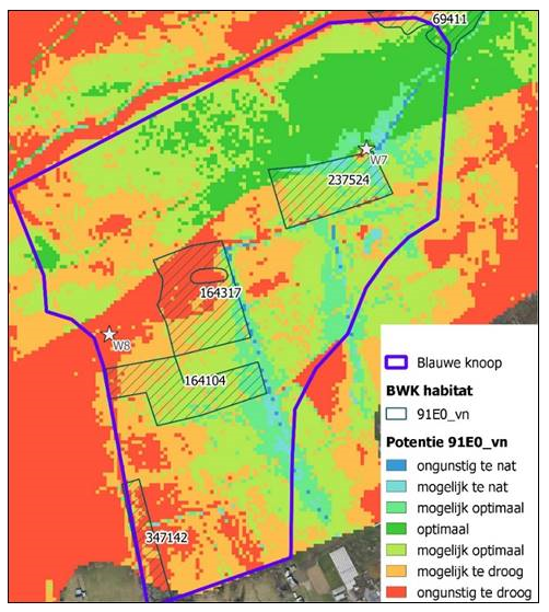
This map is an example of ecological system analysis, showing a part of the project area with two pumping stations (W7 & W8). These are represented by white stars.
LEGEND:
Red -too dry
Green - optimal condition
Blue - too wet
This area was analysed, in relation to ground water levels, for the development of an ecological forest habitat.
The red area close to pumping station W8 is indicating that it is too dry, suggesting VLM could try to reduce pumping in that area to reach better ecological conditions for forest habitat.
On the other hand, the blue area close to pumping station W7 indicates that the conditions are too wet. This means pumping in this location is needed and cannot be reduced if a forest habitat is to be sustained.